 |
||||
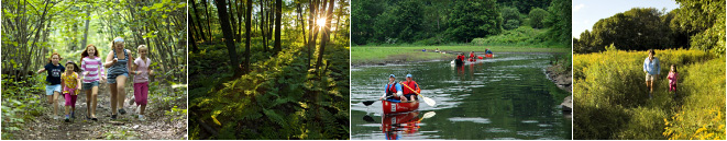
Fletcher Reserve |
||||
  |
Trail DescriptionRefer to the Anderson-Crosier-Prescott-Fletcher Trail Map. The Fletcher Reserve can be accessed via trails leading from the Nantucket Place cul-de-sac, from the Silver Lake Town Beach, or from a point on the western shore of Silver Lake on Upton Street (Rt. 140).
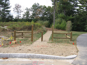
To reach the Fletcher Reserve from the circle at the end of the Nantucket Place cul-de-sac in the Mazza Farms subdivision, proceed along the access corridor marked by a pair of corner fences and identified by a Grafton Conservation Commission sign. The trail heads north over GCC property (with a CR to the GLT) to the eastern shore of the lake, then north along the lake shore until it reaches the Fletcher Reserve. It then crosses two tributaries of the intermittent George Brook. The crossings are often muddy.
The trail then enters the pine forest section and reaches the northern part of the reserve where it meets an east/west trail segment and terminates. Immediately to the west is the access to the island. The trail also heads east through the pines before turning north and heading off the reserve onto a GCC parcel. To reach the Fletcher Reserve from the Town Beach, simply proceed north on the trail that follows the shoreline. Take your first right and cross the earth dam then continue north along the eastern shore (on your left). To reach the Fletcher Reserve from the access point on Upton Street (private property), proceed north along the western shore of Silver Lake and the Miscoe Brook where it enters the lake. Keep left where the trail enters the GCC unnamed parcel at the rock walls. At the Miscoe Brook, find a safe place to ford the brook. This may not be practical in the winter and spring, but is often easy in the late summer and fall. Then proceed east and bear south over two intermittent streams until you reach the rock wall at the northern boundary of the Fletcher Preserve. When visiting these parcels, please respect the posted regulations. 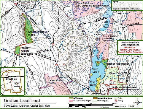
Printing instructionsThe maps print on letter-size paper. Print the trail maps using the Adobe |
|||
![]()
- Anderson-Crosier Woods
- Brigham Hill Community Farm CR
- Brigham Hill Connector
- Brigham Hill Wildlife Area
- Fletcher Reserve
- Forbush Sanctuary
- Gebelein Sanctuary
- George Knowlton Preserve
- Gummere Wood
- Harris Wildlife Preserve
- Hazzard/Pond Preserve
- Lambert Property
- Marsters Preserve
- Mazza Farm CR
- Meranto Landing
- Nicholson Family Preserve
- Old Dawes Pond Preserve
- Parker Preserve
- Platt Preserve
- Potter Hill Meadows
- Prescott Wildlife Sanctuary
- Rita Martin Preserve
- Roger Hohman Sanctuary
- Salisbury Preserve
- Williams Preserve CR
- Williams Woods